
Lêer:Santa lucia castries political.png

Grootte van hierdie voorskou: 424 × 599 piksels. Ander resolusies: 170 × 240 piksels | 339 × 480 piksels | 733 × 1 036 piksels.
Oorspronklike lêer (733 × 1 036 piksels, lêergrootte: 20 KG, MIME-tipe: image/png)
Opsomming
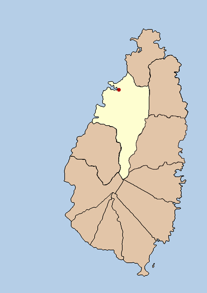
| Beskrywing | this is a political map showing the quarter of Castries on the island nation of Santa Lucia. I created it myself by using the GIMP to trace a public domain map that i found at the Perry-Castañeda Library Map Collection. |
| Datum | 21 September 2005 (original upload date) |
| Bron | Geen machineleesbare bron opgegeven. Eigen werk aangenomen (gebaseerd op auteursrechtclaims). |
| Outeur | Geen machineleesbare auteur aanwezig. Op basis van auteursrechtclaims wordt auteur Doviende~commonswiki aangenomen. |
Lisensiëring
| Ek, die outeursreghouer van hierdie werk, stel dit hiermee in die publieke domein vry. Dit geld wêreldwyd. In sommige lande is dit dalk nie wettiglik moontlik nie. Indien so: Ek verleen aan enigiemand die reg om hierdie werk te gebruik vir enige doel, sonder voorwaardes, tensy sulke voorwaardes deur die wet vereis word. |

|
File:Saint Lucia district of Castries.svg is a vector version of this file. It should be used in place of this PNG file when not inferior.
File:Santa lucia castries political.png → File:Saint Lucia district of Castries.svg
For more information, see Help:SVG. |
 |
Lêergeskiedenis
Klik op die datum/tyd om te sien hoe die lêer destyds gelyk het.
| Datum/Tyd | Duimnael | Dimensies | Gebruiker | Opmerking | |
|---|---|---|---|---|---|
| huidig | 03:43, 21 September 2005 | | 733 × 1 036 (20 KG) | Doviende~commonswiki | this is a political map showing the quarter of Castries on the island nation of Santa Lucia. I created it myself by using the GIMP to trace [http://www.lib.utexas.edu/maps/americas/saint_lucia.gif a public domain map that i found] at the Perry-Casta� |
Lêergebruik
Die volgende bladsy gebruik dié lêer:
Globale lêergebruik
Die volgende ander wiki's gebruik hierdie lêer:
- Gebruik in am.wikipedia.org
- Gebruik in ban.wikipedia.org
- Gebruik in bn.wikipedia.org
- Gebruik in cy.wikipedia.org
- Gebruik in en.wikipedia.org
- Gebruik in fa.wikipedia.org
- Gebruik in fi.wikipedia.org
- Gebruik in hr.wikipedia.org
- Gebruik in hu.wikipedia.org
- Gebruik in id.wikipedia.org
- Gebruik in incubator.wikimedia.org
- Gebruik in ja.wikipedia.org
- Gebruik in ko.wikipedia.org
- Gebruik in mk.wikipedia.org
- Gebruik in ml.wikipedia.org
- Gebruik in mr.wikipedia.org
- Gebruik in nl.wikipedia.org
- Gebruik in nn.wikipedia.org
- Gebruik in ps.wikipedia.org
- Gebruik in sah.wikipedia.org
- Gebruik in sh.wikipedia.org
- Gebruik in sv.wikipedia.org
- Gebruik in ta.wikipedia.org
- Gebruik in th.wikipedia.org
- Gebruik in tr.wikipedia.org
- Gebruik in ur.wikipedia.org
- Gebruik in vi.wikipedia.org
- Gebruik in yo.wikipedia.org
- Gebruik in zh-min-nan.wikipedia.org